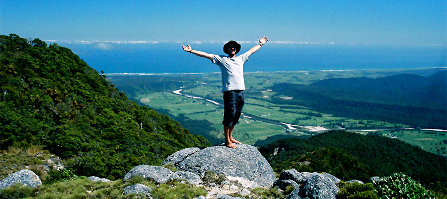
Mt Stormy, which is shaped like a densely forested Ayres Rock, looms over Karamea and offers a great day walk for people staying in the town. The track starts about 7 kilometres from Karamea township, crosses farmland at the base of the mountain and then winds up through several distinctly different forest types to the summit at 1084 metres.
The track is a DOC-maintained bush track that is quite challenging for fit and experienced trampers. There are two stream crossings and an incredible land bridge about 30 metres long that can be daunting for acrophobic people, as the track is quite narrow and there is a steep drop on both sides.
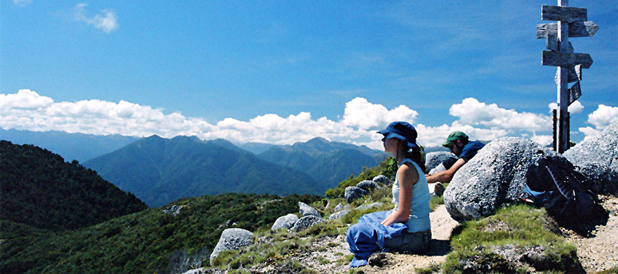
The track emerges above the tree line and finishes at a signpost that points to and names the mountain peaks visible from the top. From the summit, stunning views over the forested mountain peaks of the Kahurangi National Park, Karamea River, township,the wild West Coast and even to the North Island on a very clear day are rich rewards for the effort required to climb the mountain.


Allow 6-8 hours for the return trip and follow the orange triangular markers that define the track. Please ask your accommodation provider to call ahead, out of courtesy to the farmer, for permission to cross his land before beginning the walk.
For transport to the Mt Stormy Track, please contact Karamea Connections: KarameaConnections.co.nz